Day 53-66

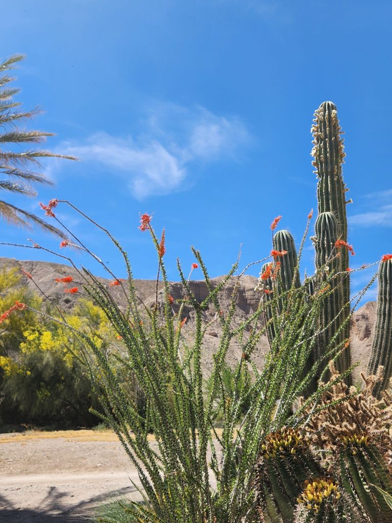
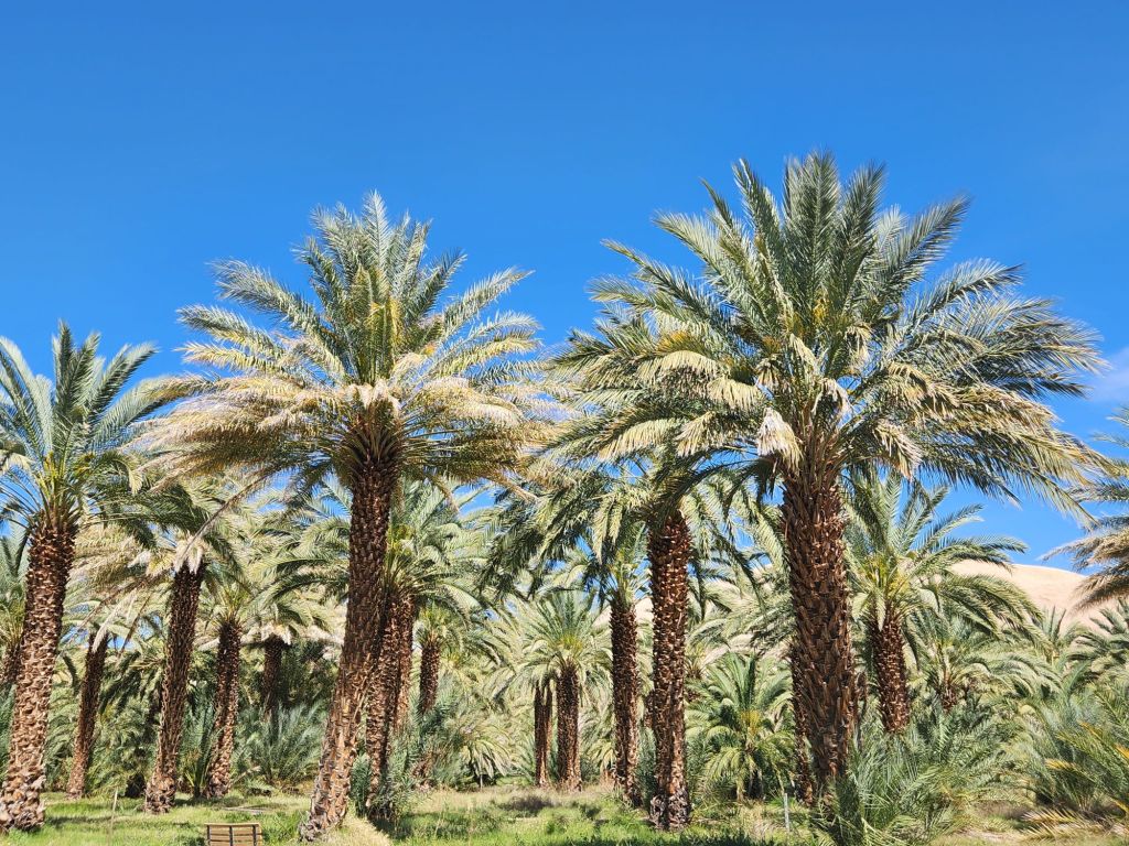
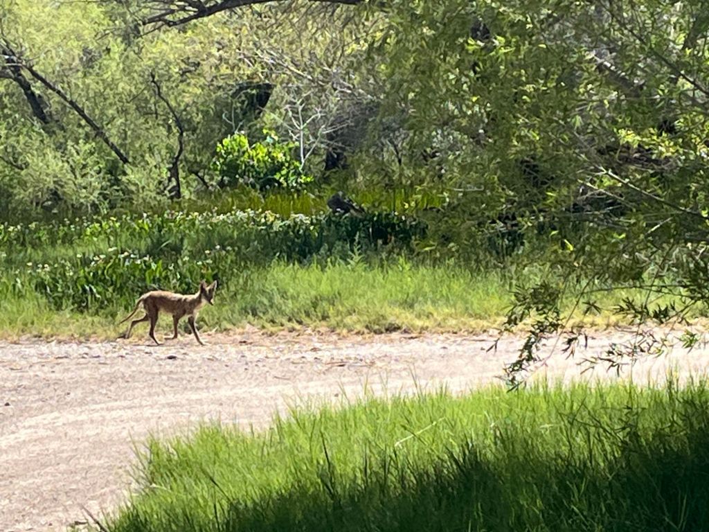
Per the suggestion of a hotel employee in Death Valley we took a detour toward Tecopa, CA, to visit the China Ranch date farm. It was in the bottom of its own little canyon surrounded by ledges and had some wonderful cacti starting to bloom. I was shocked to learn that dates grow on palm trees…I had no idea! The other visitors all stayed in the area with the store but we walked to the grove of trees and saw an interesting creature: 4-legged, very skinny, big ears and along skinny tail. He stalked us for several minutes before turning away. When we returned to the store to purchase our date shake, medjool dates, date cookies and date brownies (we couldn’t resist trying some new things and no, we didn’t eat them all in one day!), we asked the salesperson about the strange creature. She laughed and said it’s one of the mangy coyotes that comes down to feed on the fallen dates but when the dates were out of season they get really skinny. Maybe we could grow some date palms some day!
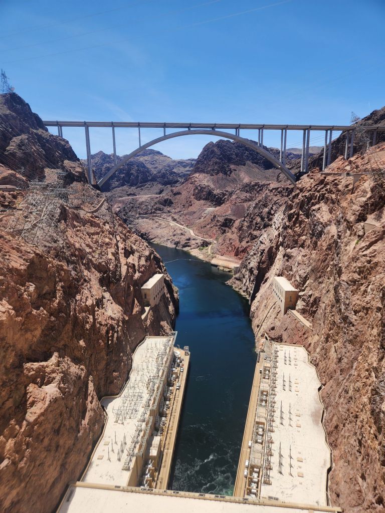
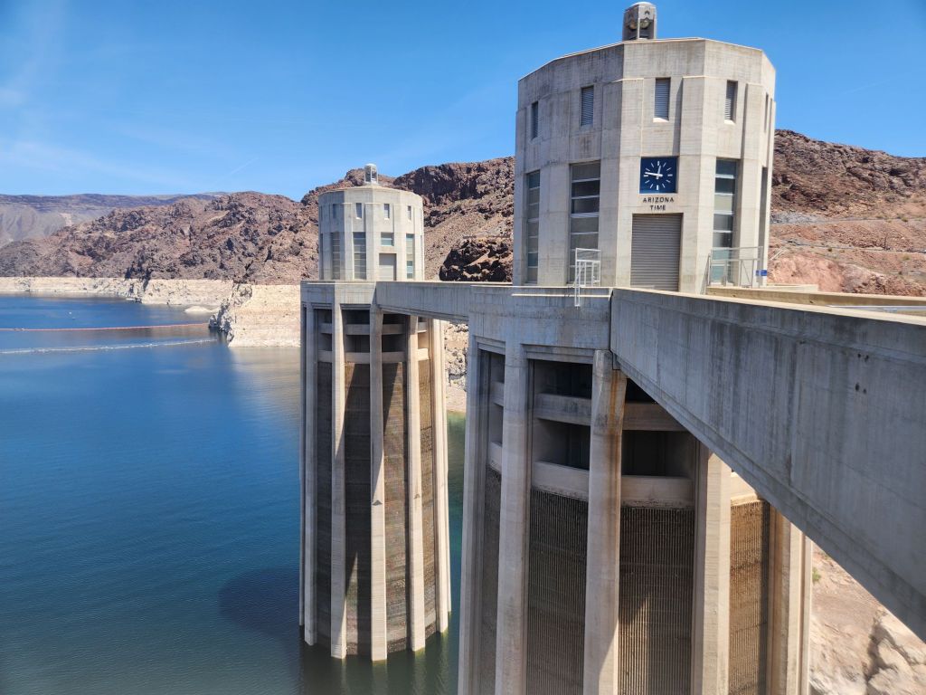

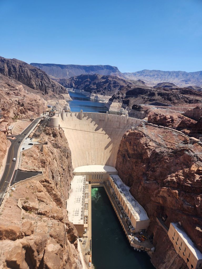
Boulder City, NV, home to Boulder Dam and the Pat Tillman bridge, was our next stop. We walked the bridge and toured the bowels of the dam and Scott was thrilled. Honestly, all that electricity talk was above my pay grade but it was compelling.


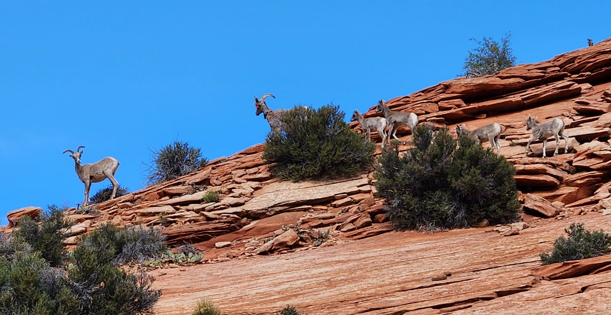
The cute little town of Springdale, UT was where we stayed in a little authentic log cabin. We spent 2 days exploring Zion National Park and observing the crazy…I mean brave, folks climbing/rappelling vertical rocks. For several days we had been commenting that we really would like to see a big horn sheep. To our delight, we watched 12 Desert Big Horns right by the road as we were leaving the park! We sat for quite some time observing and shooting tons of pictures while they did their thing.
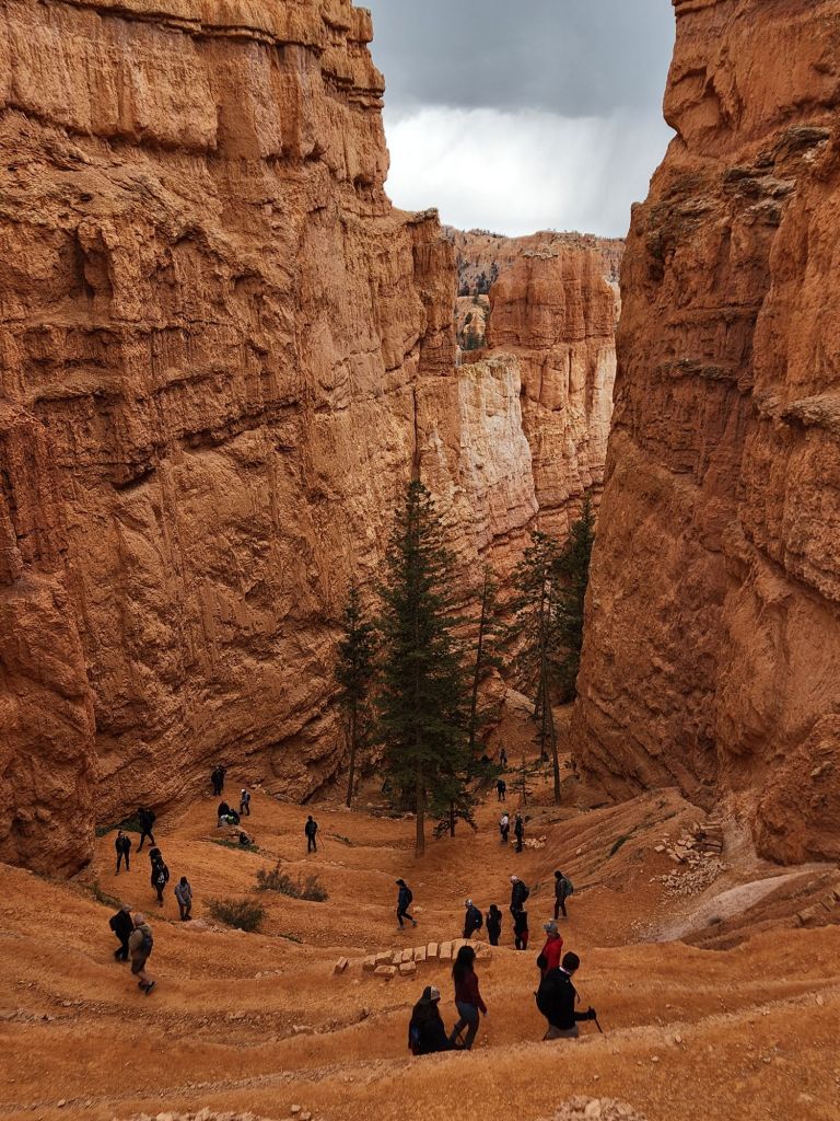
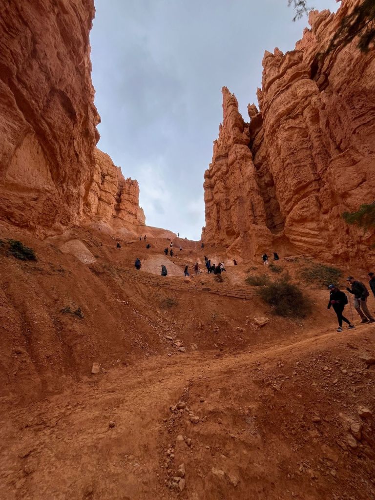
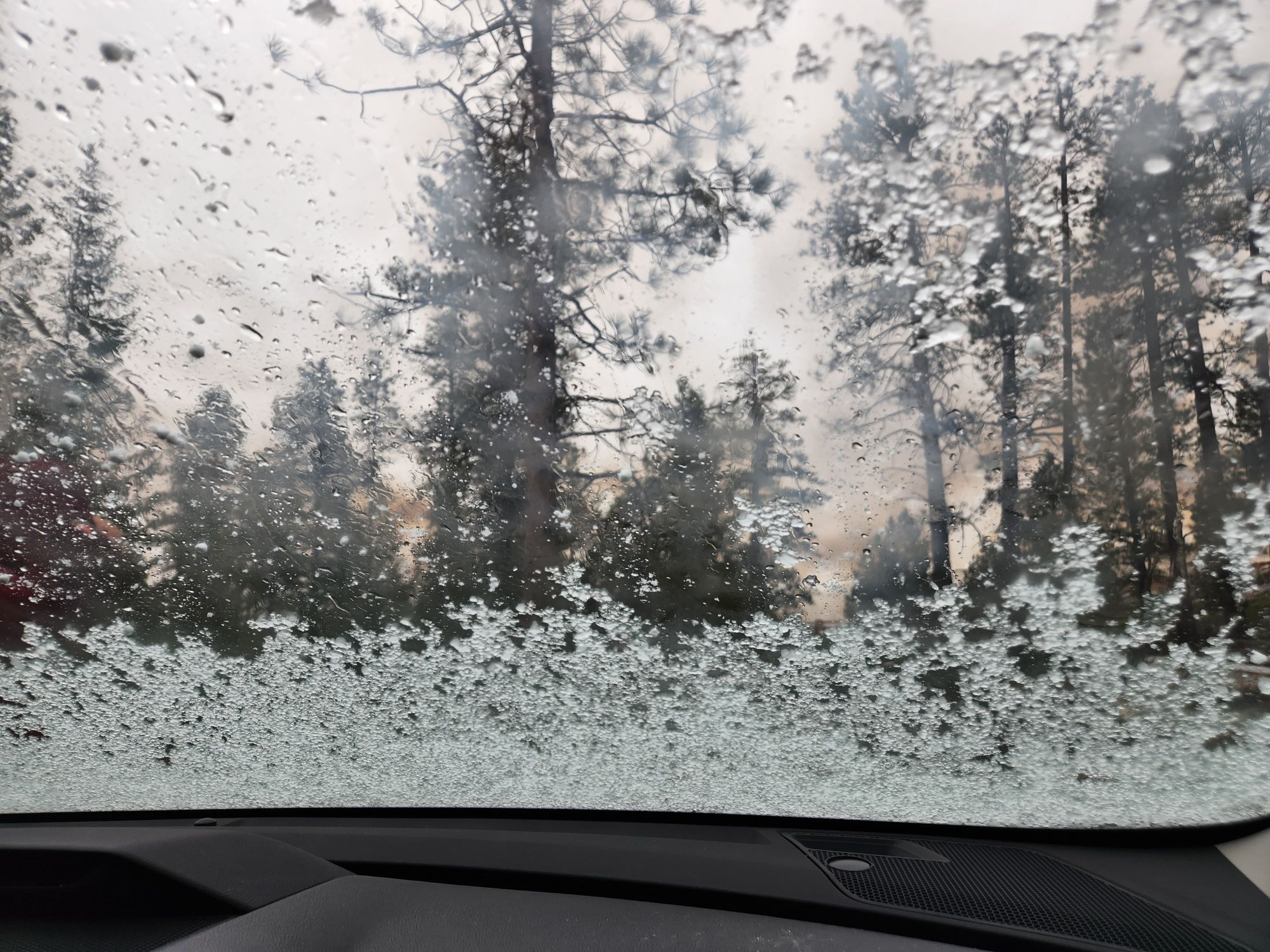


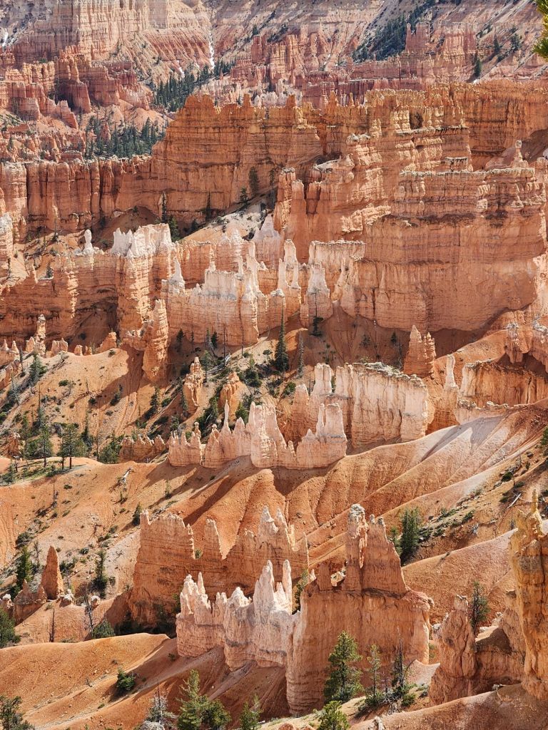

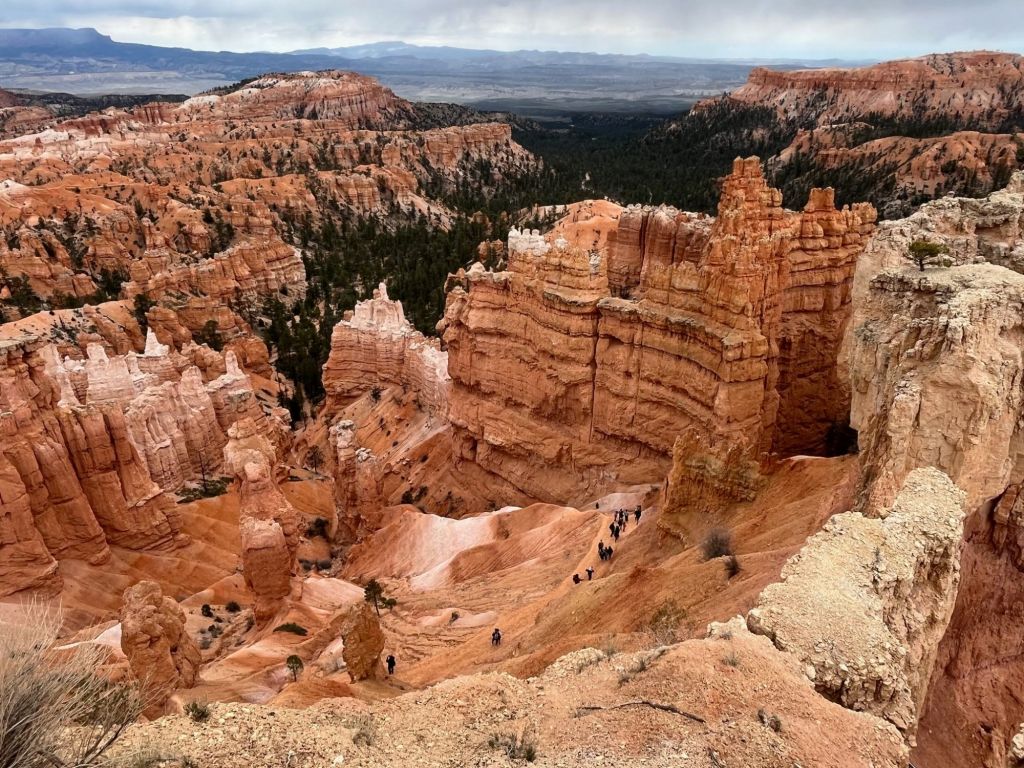
We spent two days in Bryce Canyon and each day blew my mind, in fact, I was more impressed with Bryce than with the Grand Canyon. We took two vigorous hikes down among the hoodoos (tall, thin spires of layered rock formed by erosion). There are many signs in the park explaining that in case of thunder go quickly into the lodge or into your car. Just as we got to the bottom of the Navajo Trail we heard thunder. Boy, did we huff and puff quickly back up the 800′ drop in elevation. We scrambled into the car just as a massive quantity of ice pelted us. Both days we were in the park we had periods of sun, rain, sleet and snow but that didn’t dampen our spirits nor our love for these colorful and unique formations. An interesting tidbit…Bryce canyon isn’t actually a canyon; it’s a series of amphitheaters or bowls carved into the edge of a high plateau carved by erosion. Canyons are formed by rivers. We took more pictures in Bryce than we have any place else on this trip. The pictures vary greatly depending on the location of the viewpoint.


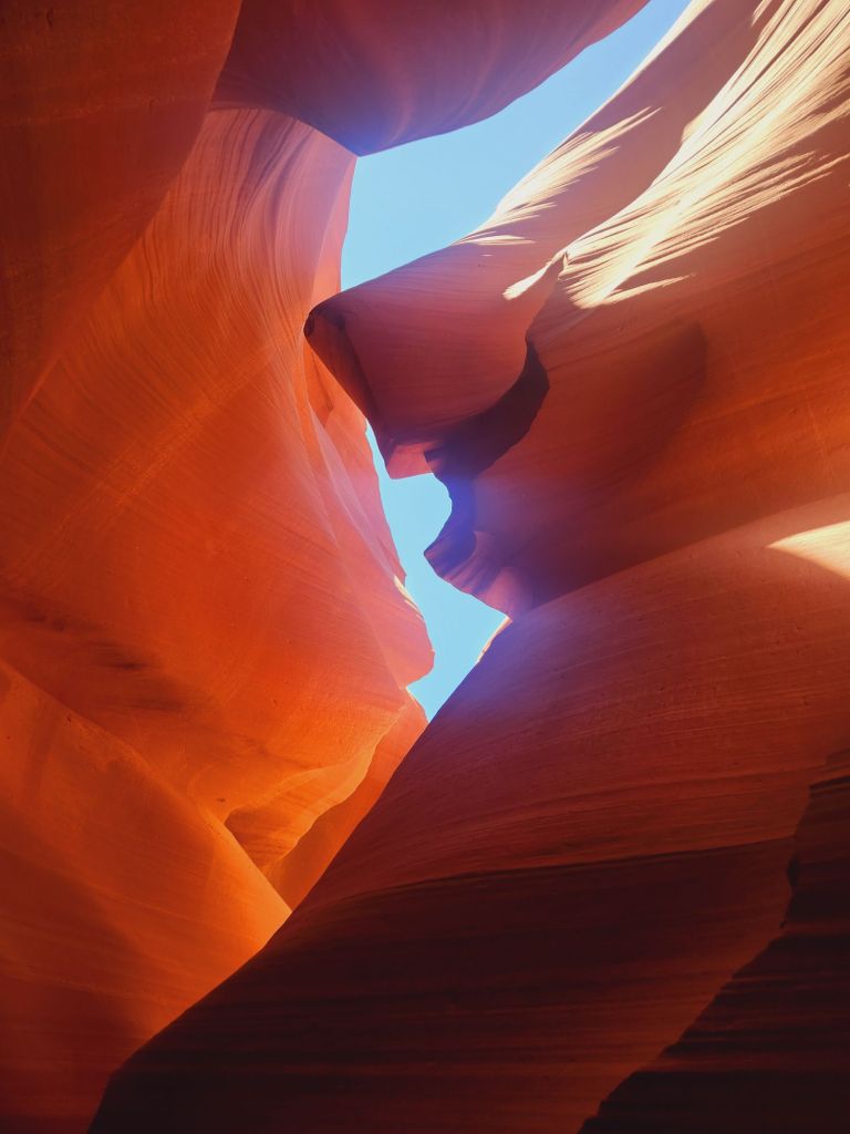
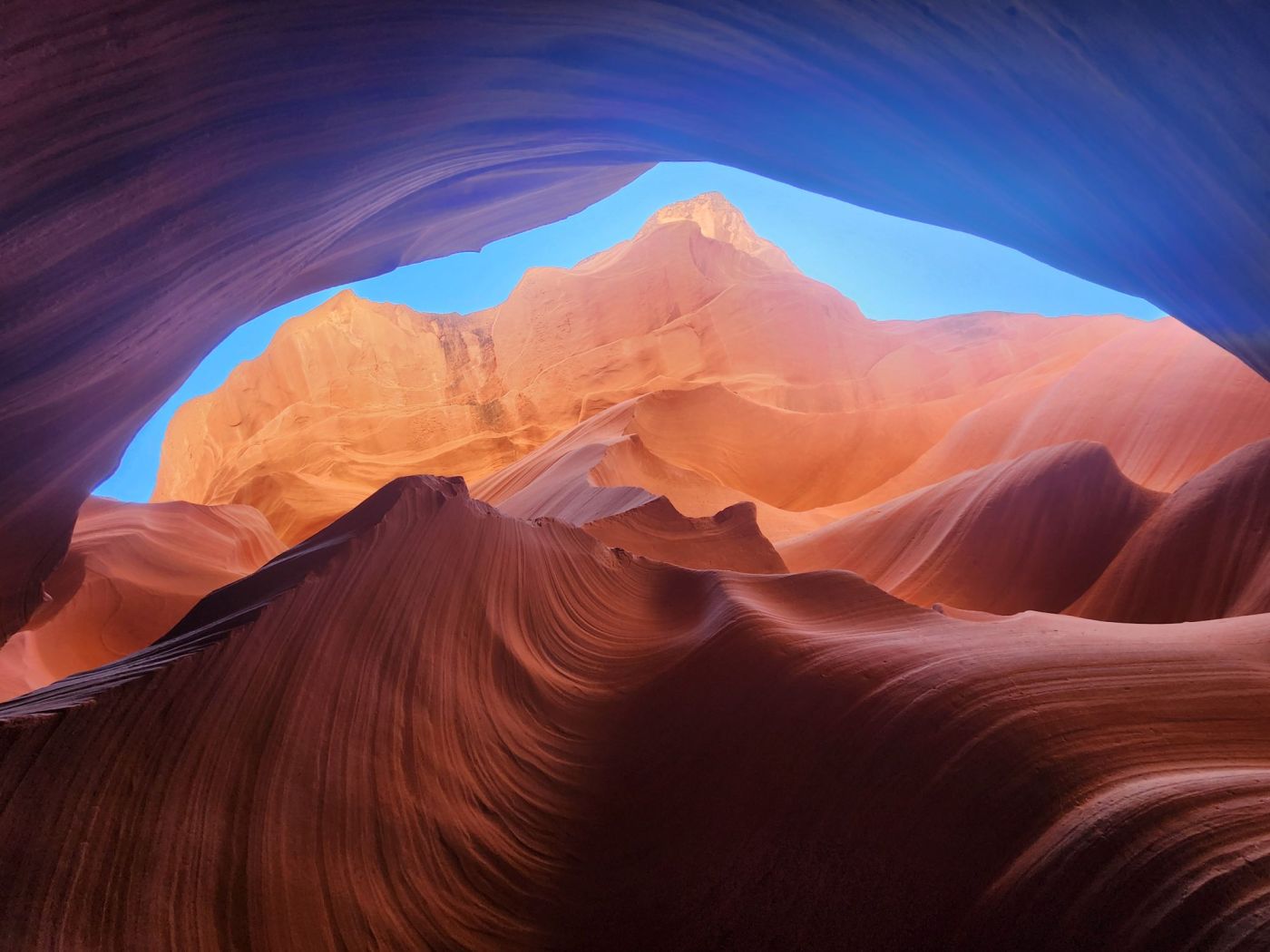
We traveled along the Vermillion Cliffs and saw some odd rocks precariously perched atop other rocks. Antelope Slot Canyon is located in the Navajo Nation and is a pretty amazing narrow crack in the flat desert formed over millions of years by floods rushing through the sandstone. We walked underground for 1335′ on a path as narrow as the width of my foot . Our guide was kind enough to give us tips on taking better pictures with our cell phones and took pictures of the two of us. The light streaming down into the slot created some cool photos. In actuality, it was impossible to take a bad picture in there. Horseshoe Bend is another famous spot in Page but we only took 2 pictures as the water in the Colorado River there was green and not too photogenic.
Back up to Utah to the sweet town of Torrey where we had the best biscuits of our lives. On our scenic drive we experienced our highest elevation so far of 9600′. We saw many Aspen trees and vast areas untouched by humans, sometimes with 2′ of snow. Over the next several days we saw so many signs stating “Open Range” with a picture of a cow and often the cows were grazing right beside the road. Gargantuan views , 14% downhill grades with switchbacks, ridges where both sides dropped off for 100’s of feet and nary a side rail created quite the dramatic drive.


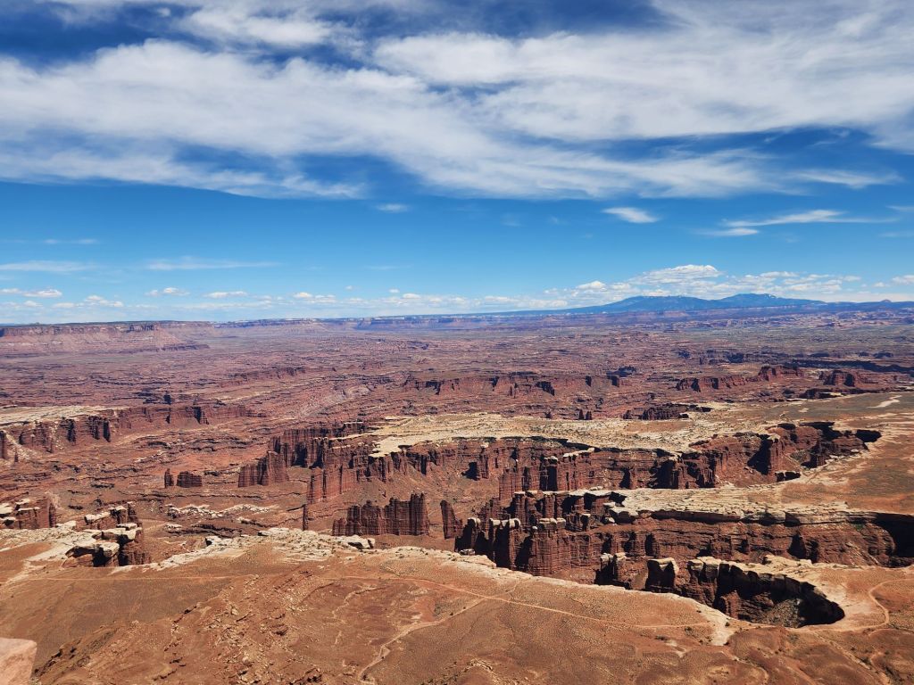
En route to Canyonlands National Park Scott had an opportunity to fly his drone but didn’t get any notable shots. They are not allowed in any of the national parks. In Canyonlands, however, we took some nice hikes with panoramic views.

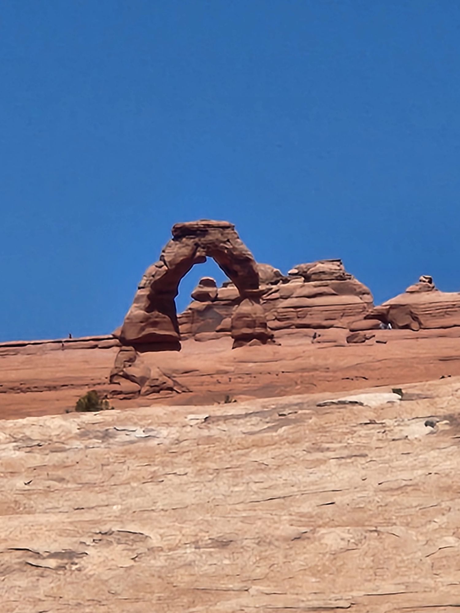

In Arches National Park, with over 2000 arches, we learned so much about the way the arches were formed beginning 65 million years ago. In a nutshell…with the freezing and expansion of snow sandstone chunks break off. Over millions of years this fracturing process turns rock layers into fins and fins into arches.
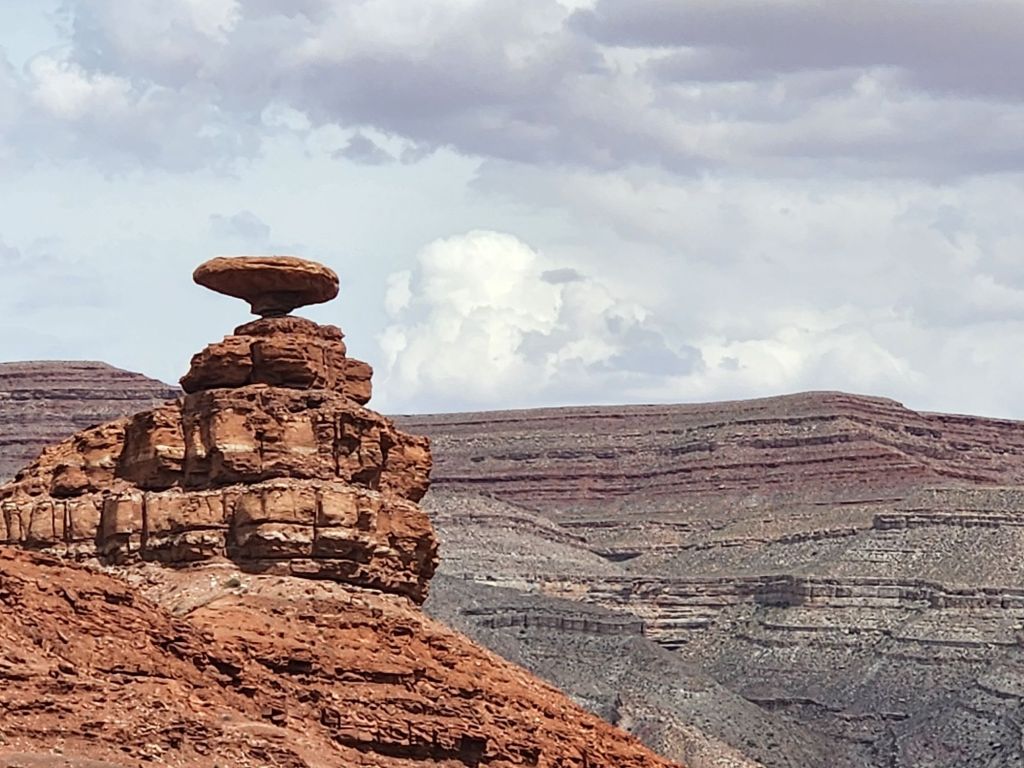


On our way south to the town of Mexican Hat, population 40, we took the 17 mile scenic drive through the Valley of the Gods. Valley of the Gods is part of the Bear’s Ears National Monument but the gravel road is rough and holey. Perhaps that’s why we only saw about 12 other cars. In these areas the vistas and rock formations were so spread apart that photos really didn’t do justice…the lands are just too big. The town of Mexican Hat is named after the nearby rock that resembles an upside down sombrero, somewhat loosely. The following day we visited the Monument Valley Navajo Tribal Park. We stood in the middle of the road to take the picture of Forrest Gump’s run through the desert. At least we didn’t lie down on the concrete like some Instagrammers! After reading the reviews of the drive through the Park we passed on on damaging our new car, it was said to be worse than Valley Of The Gods. Instead we did something even better…went to the Burger King in Kayenta!


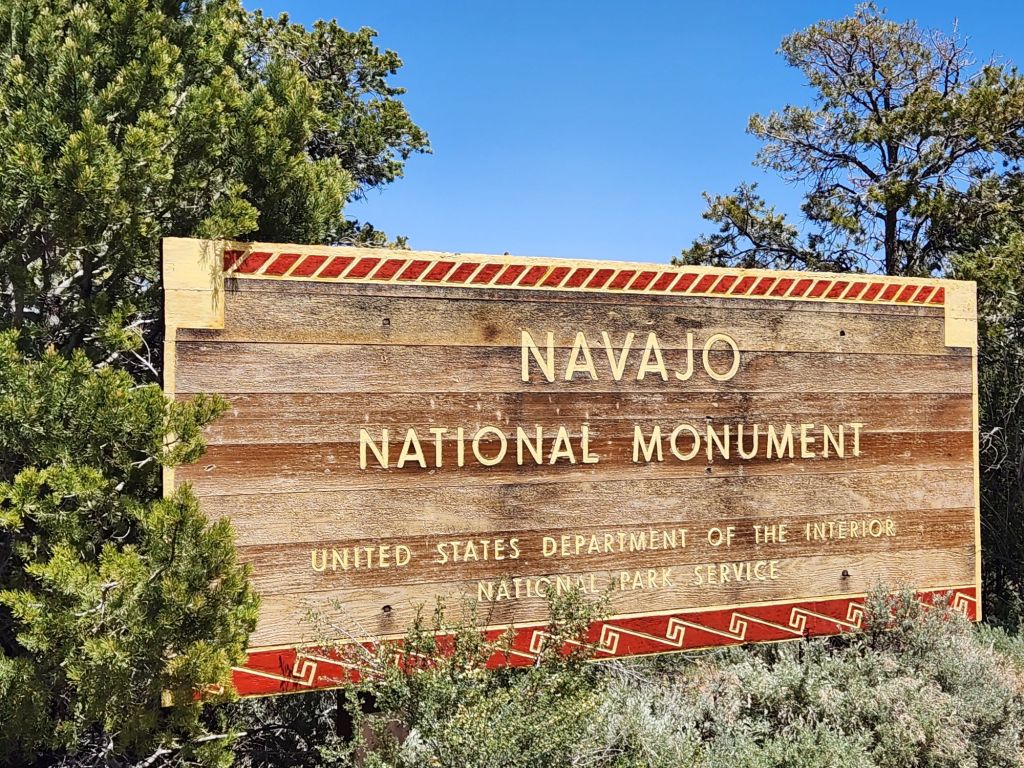

Yep, went 28 miles out of the way to the Burger King, not to eat but to see the exhibit for the famous WWII counterintelligence program, the only code that was never broken. The group of 29 Navajo marines created the code from their native tongue which was solely a spoken language. These men were real war heroes and this was a fabulous story to dive into. Next door to the Burger King there was a display of a shade house, a sweat lodge, and both female and male hogans, all of which are still in use today by local Native Americans. We continued our education regarding Puebloans’ life centuries ago in the Navajo National Monument where we could view the village built in 1250 within the alcove of a rock face. The ancestral Puebloan dwellings were architecturally sophisticated and large, housing around 150 people. Situated on the side of a cliff people had to climb ladders while laden with children and food such as their corn and squash crops and small animals. After about 36 years they migrated to another area which was their normal way of life. We had a fascinating conversation with two local Puebloans about their difficulty in maintaining their native traditions and practices.
After zig-zagging our way through Utah and northern Arizona we next head to Colorado and New Mexico.

Thanks, Melissa! Very interesting post an wonderful photos.
LikeLiked by 1 person
Thanks, Tom!
LikeLike
Beautiful photos of a spectacular adventure! Loved seeing the Desert Big Horns!
LikeLike
wow !! Great adventure! We’ve been to some of these areas and love it!! The red rock formations are outstanding!!
thanks for sharing
miss you! ♥️Barb
LikeLiked by 1 person